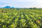
Robeco uses satellite data to check whether forests in Malaysia and Indonesia are being deforested with the aim of making room for new palm oil trees. For this purpose, high-resolution images from orbit will be used in order to carry out a continuous before and after comparison of the forests in these regions. For Robeco, addressing sustainability issues in the palm oil industry is an important aspect of its commitment to sustainability in the context of the SRI investments in 2019.
Here is the whole story.